2024 Noto Peninsula Earthquake Inspection
On May 14 and 15, I accompanied the Noto Peninsula earthquake survey.
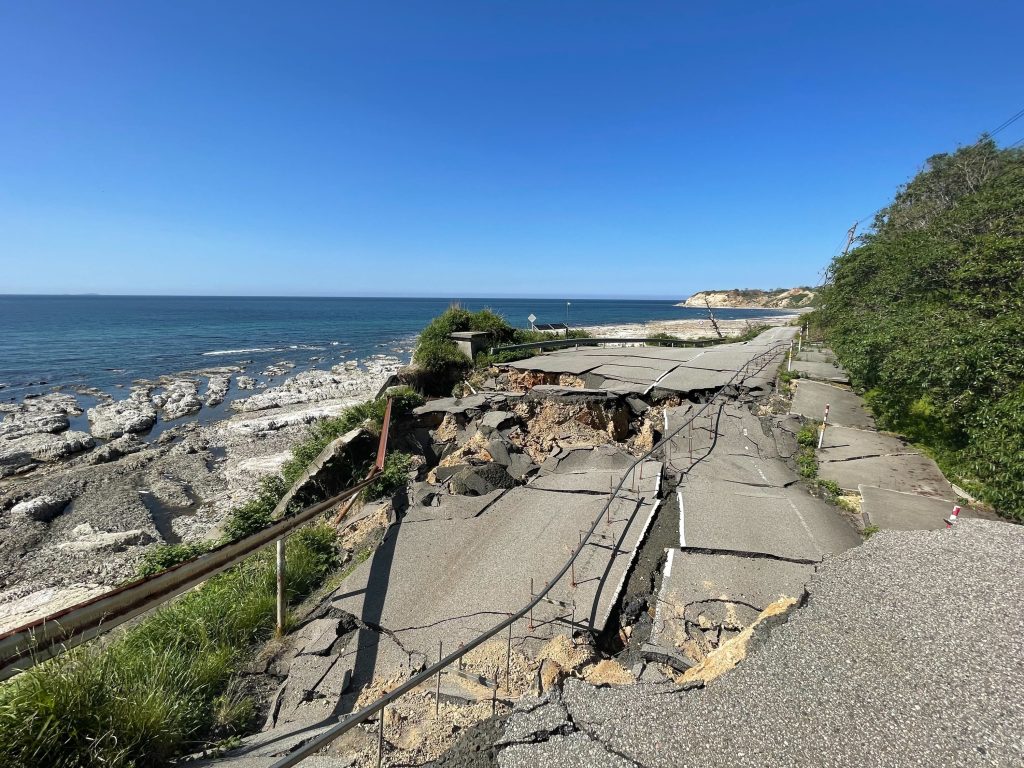
Through the survey, first of all, I felt that the topographical factors of the Noto Peninsula played a major role in the disaster. One of the few roads in the peninsula was blocked by collapses and sediment, which hindered the movement of people and goods, the key to disaster response and recovery. Along the northwestern coast of the Noto Peninsula, the ground was uplifted and ports were made unusable. Liquefaction and land subsidence also occurred on soft ground, damaging much infrastructure. Tunnels and bridges located in landslide zones were rendered impassable by the landslides. However, even with some unique topographical factors, the worsening problems that contribute to disaster damage are common throughout Japan, such as urban concentration, aging buildings and infrastructure, and the declining birthrate and aging population.
In a situation where people, goods, and money (and information, especially immediately after the disaster) are still not being gathered to their full potential, some opinions may not be fully understood when considering priorities and methods for reconstruction and restoration, and some decisions may be difficult to make. I was encouraged to see people in various positions working hard and devising creative solutions, and at the same time, as a person involved in infrastructure, I was keenly aware of my own responsibility to do so.
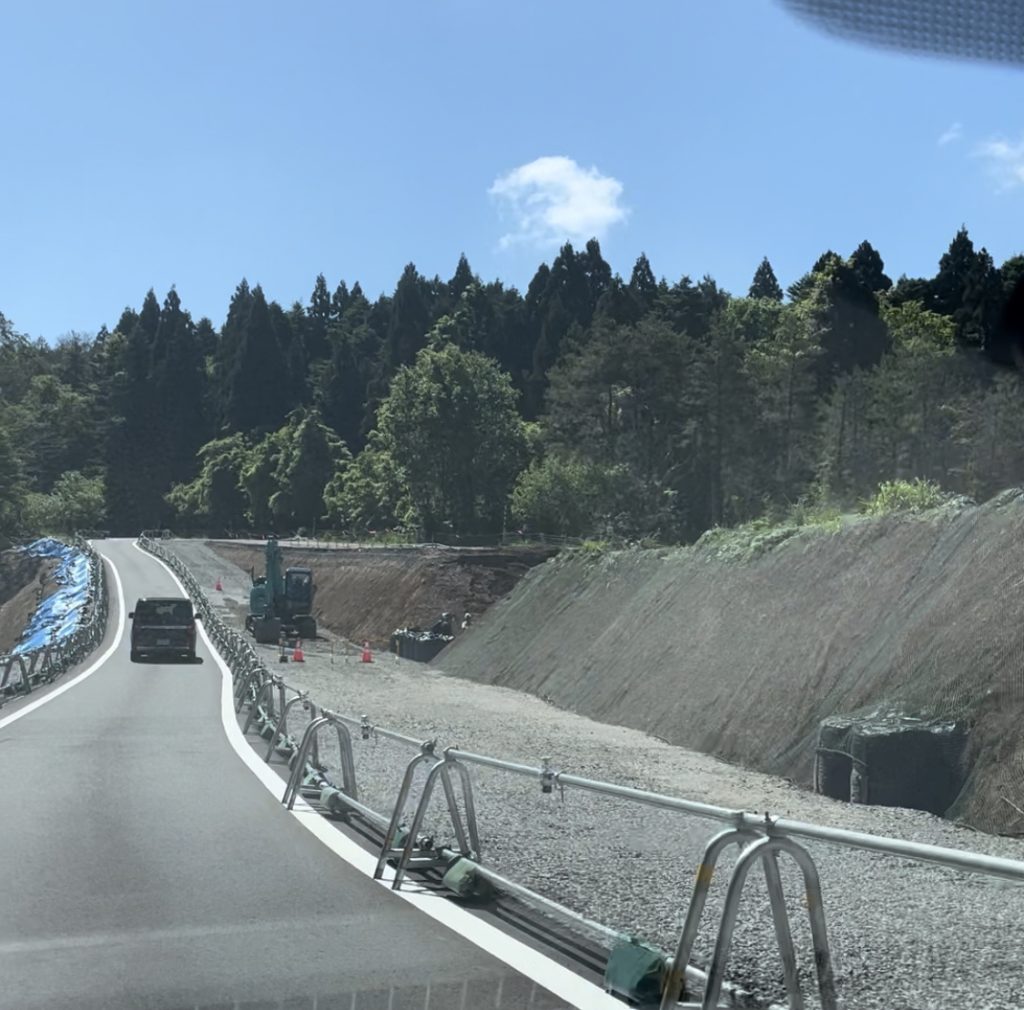
I would like to introduce some of the most memorable landscapes from the survey, The first is National Route 249 along the coast, which was impassable at many points due to collapsed slopes. The second is the Noto Satoyama kaido, where there were many collapsed embankments. The road was re-built with embankments, detours were built, bridges were constructed, ramps were used, and other ingenious measures were taken to make it possible to move toward Wajima City.
[Mega]